Clouds
Introduction
Observing clouds can be very fascinating. Those interested in clouds also have the advantage of enjoying a cloudy day to discover new cloud types. Admittedly, a high fog layer is not very exciting, especially when you have to observe it for several weeks in winter, but there are many other, more exciting cloud types.

Altitudes (Levels)
Clouds are classified based on various characteristics. First, it is classified in which altitude range a cloud is located. Three altitude classes are distinguished, and a class that extends across all three altitude layers.
Low clouds include, for example, the well-known fluffy clouds, small cumulus clouds also called fair-weather clouds. Clouds in the middle layer are referred to as Alto. In the uppermost layer, there are pure ice clouds, such as the well-known Cirrus clouds, also called feather clouds. Across all three cloud layers, there are powerful thunderclouds, clouds with vertical layering. Another cloud that extends across all three layers is Nimbostratus. We experience this cloud rather unspectacularly, as it can rain heavily for hours. So, we never really see this cloud as a whole, only from below when it's raining.

Cloud Type (Genus)
Another distinguishing feature is the appearance of the cloud, which also allows conclusions about the formation process. Clouds are classified into layer clouds, Stratus, and heap clouds, Cumulus.
Stratus, for example, is created by lifting processes, for example, when warm air masses slide over a cold air mass and layer clouds form in the boundary layer. Stratus can form at all three altitudes (with a warm front, you observe the formation in the upper, middle, and then lower layer over time). If a high fog layer is very low, it is simply called Stratus, i.e., layer cloud in the lowest layer. In the middle layer, the same cloud is called Altostratus, and in the uppermost layer, it is called Cirrostratus. Since the latter is an ice cloud, you can see optical phenomena such as halos in it.
Cumulus clouds are formed by strong vertical currents, which can arise, for example, due to strong thermal heating (thermal thunderstorms) or by lifting processes at frontal boundaries, for example, at a cold front. Since cold air is heavier than warm air, the cold air layer cannot simply slide over the warm one; it breaks in, leading to strong turbulence or strong vertical compensating currents. However, Cumulus clouds can be harmless, for example, if they only float in the lower cloud layer as fair-weather clouds or fluffy clouds in the sky. In the middle layer, they are called Altocumulus, and in the uppermost layer, Cirrocumulus.
Further Classifications and Companion Clouds
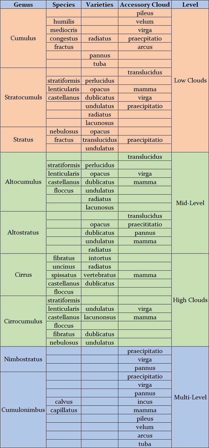
In addition to this rough classification, there are further differentiation features (Species), listed in the table below. For example, a Cumulus in the lowest air layer is called humilis (wider than high), mediocris (as high as wide), or congestus (higher than wide). If it has no clear lower edge (condensation level), it is called fractus.
Whole cloud formations are also given a nickname (Varieties). If a cloud layer is transparent, it is called translucidus; if cloud bands are radially distributed in the sky, they are called radiatus, or if waves are visible, the term undulatus is used.
Finally, there are also so-called accessory clouds, clouds that appear more as accompanying phenomena. If a cloud, for example, has streaks of falling rain, snow, or ice on its underside, this is called virga. If these streaks reach the ground, they are called praecipitatio.

Table and Tips
The table below provides a good overview of cloud classification. However, precise identification in the sky is not always easy and not always unambiguous. For those who want to start (and I can only recommend it), one of the books that allow an easy entry into the subject is recommended. Descriptions by the Cloud Appreciation Society, such as the booklet "The Clouds Collector Handbook," are very good. Here, you will find many helpful tricks for cloud identification. A simple method is, for example, the height determination of heap clouds by hand. If you stretch out your arm, the width of a finger is about 1 degree. Clouds floating more than 30 degrees above the horizon can be measured this way. If they are smaller than a finger, they are Cirrocumulus; if they are wider than three fingers (about 5 degrees), they are Cumulus; in between, they are Altocumulus. This determination method is also helpful for Halos. The distance between the spread thumb and little finger is about 22 degrees. So, you can easily determine a 22-degree halo (and consequently, you have also determined Cirrostratus).

Cloud Images
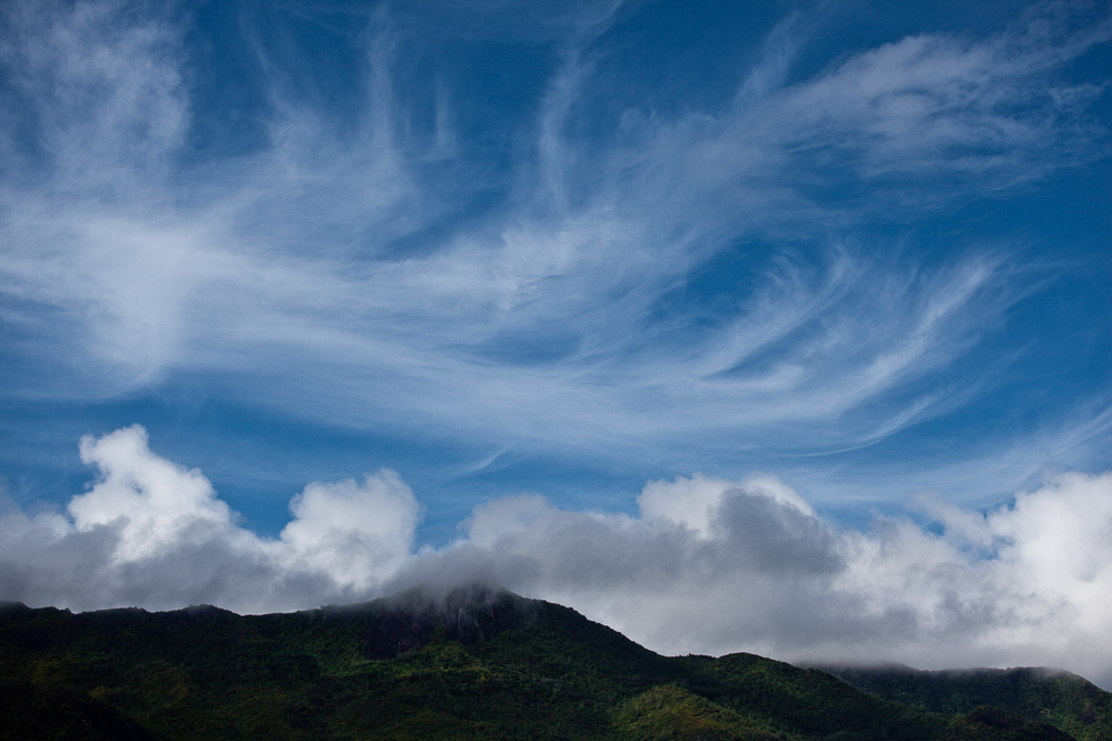
Seychelles Cloudscapes, Mahé

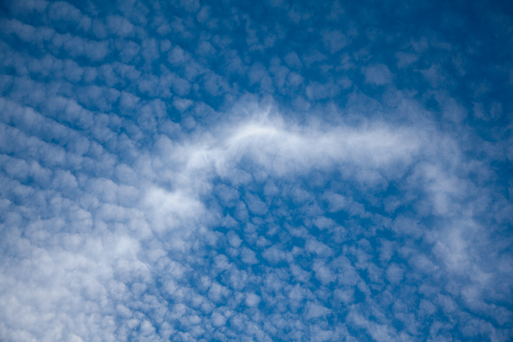
Clouds over HongKong

Clouds, Collection 1
